Marine Technology and Ocean Monitoring: The Industry
Canada has the longest coastline in the world and some of the sparsest ocean monitoring coverage per kilometre of any comparable coastal nation. That gap is the defining structural feature of Canada's marine technology landscape.

Canada has the longest coastline in the world. It also has some of the sparsest ocean monitoring coverage per kilometre of any comparable coastal nation. That gap between geographic scale and observational capacity is the defining structural feature of Canada's marine technology landscape, and it shapes everything from how fisheries are managed to how sovereignty is exercised in the Arctic to how climate data is collected and used.
The marine technology and ocean monitoring sector in Canada is not a single industry. It is a collection of overlapping systems, institutions, and firms spanning government science, academic research, commercial instrumentation, defence surveillance, and Indigenous stewardship programs. Understanding it requires separating those layers rather than treating them as a unified whole.
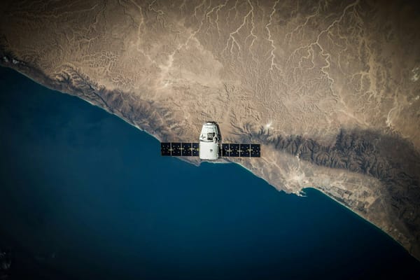
The government layer is the foundation. Fisheries and Oceans Canada operates research laboratories, the Canadian Hydrographic Service, and a national network of buoys, tide gauges, and coastal radar that collectively form the backbone of Canada's ocean observation system. The Canadian Ice Service charts sea ice conditions across Arctic and coastal waters. The Canadian Space Agency operates the RADARSAT constellation, which provides all-weather radar imaging of ice cover, vessel traffic, and ocean surface conditions across Canada's three ocean coastlines. Environment and Climate Change Canada contributes weather and atmospheric monitoring that intersects with ocean systems at multiple points. Together these agencies represent the most extensive and reliable layer of Canada's ocean monitoring capability, though their coverage is uneven and their funding is subject to political cycles rather than long-term operational commitments.
The academic layer adds depth and continuity. Ocean Networks Canada, operated through the University of Victoria, runs cabled and wireless observatories on the Pacific, Atlantic, and Arctic coasts, collecting continuous data on temperature, salinity, currents, chemistry, and biological activity across all three ocean environments. Its Oceans 3.0 platform provides open access to decades of observatory data for researchers worldwide. ArcticNet coordinates multidisciplinary Arctic science across more than thirty Canadian universities and government agencies. The Bedford Institute of Oceanography in Dartmouth, Nova Scotia, is Canada's largest ocean research facility, producing the scientific foundation for fisheries assessments, climate monitoring, and ocean mapping. These institutions generate data and expertise that no commercial market would independently fund, making them essential infrastructure for the broader sector.
The commercial layer is smaller than Canada's coastline might suggest, but it contains genuine global strengths. Teledyne CARIS, based in Fredericton, New Brunswick, is one of the world's leading providers of hydrographic software, used by charting agencies, navies, and survey companies globally to transform raw sonar data into navigable charts. AML Oceanographic in Victoria has been manufacturing hydrographic and oceanographic instruments since 1974, exporting precision sensors to research institutions and survey companies around the world. Ocean Sonics in Nova Scotia designs and builds digital hydrophones used in both scientific and industrial applications. Cellula Robotics in Vancouver develops long-endurance autonomous underwater vehicles powered by hydrogen, capable of operating for weeks without surfacing. Kraken Robotics in Newfoundland and Labrador has built global reach in subsea imaging and mine-detection technology. These companies represent Canada's commercial marine technology edge, and they cluster around specific niches, hydrographic software, acoustic sensing, and autonomous vehicles, rather than across the full technology spectrum.
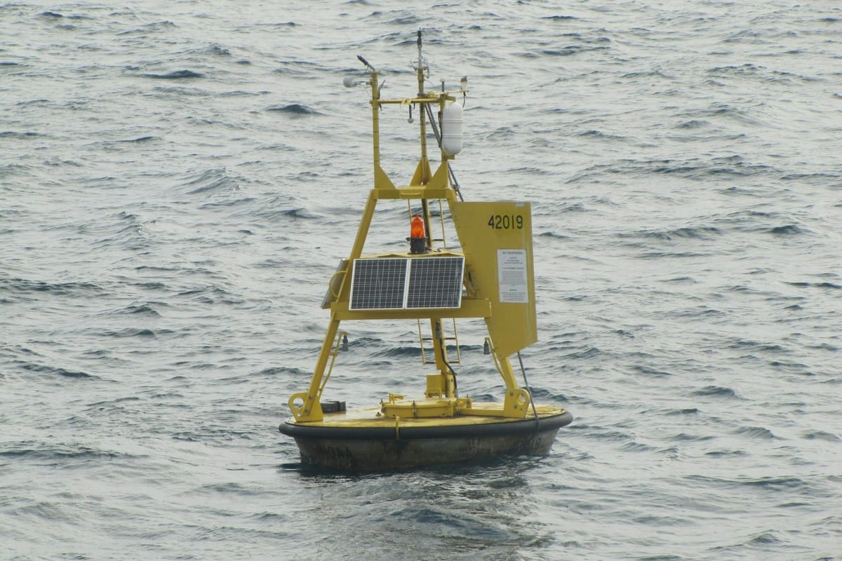
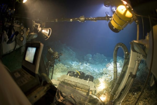
The technology itself spans a wide range of systems. Fixed observatories and moored buoys provide continuous baseline data. Autonomous underwater vehicles survey the seabed and inspect subsea infrastructure without requiring vessels to remain on station. Remotely operated vehicles allow real-time human control for inspection and sampling at depth. Satellites provide wide-area coverage of ice, ocean surface conditions, and vessel movements. Acoustic systems detect and monitor marine life, underwater infrastructure, and subsurface activity. Environmental DNA sampling identifies species from water samples without direct observation. Each technology category has its own operators, its own funding model, and its own level of commercial maturity, ranging from the fully established market for navigation charts and vessel monitoring systems to the still largely research-stage world of eDNA and autonomous Arctic sensing.
What holds this system together is not a single coordinating institution but a web of government procurement contracts, academic research grants, public-private partnerships, and international collaborations. Canada participates in the Global Ocean Observing System, shares satellite data with international partners, and contributes to Arctic monitoring networks through scientific cooperation agreements. That participation gives Canadian researchers access to global datasets and gives Canadian technology firms international credibility. It does not, by itself, solve the fundamental structural challenge of monitoring a coastline of Canada's length with the resources available for the task.
The practical consequence of that gap is that ocean monitoring in Canada is a system of trade-offs rather than comprehensive coverage. The Atlantic and Pacific coasts have relatively dense networks of weather buoys, coastal radar, and research infrastructure built up over decades. The Arctic has far fewer permanent stations and relies heavily on seasonal deployments, satellite coverage, and the occasional research expedition. Deep ocean monitoring is sparse almost everywhere. The result is a system that is genuinely world-class in specific places and specific niches while leaving significant portions of Canada's ocean territory monitored infrequently, seasonally, or not at all.